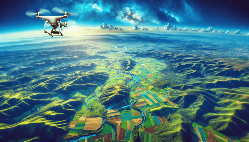
Have you ever wondered how photographers capture stunning images from incredible heights? Aerial photography is the answer! This captivating form of photography involves capturing images from an airborne position, providing a unique and breathtaking perspective. Whether it’s capturing mesmerizing landscapes, architectural wonders, or documenting events from the sky, aerial photography offers a whole new dimension to traditional photography. By utilizing drones, helicopters, or airplanes, photographers can explore the world from above, resulting in awe-inspiring and visually striking photographs. So, let’s take a closer look at the fascinating world of aerial photography and discover the magic it brings to our visual experiences.

Definition of Aerial Photography
Introduction to Aerial Photography
Aerial photography is the art and science of capturing photographs from an elevated position, typically from an aircraft, drone, or other aerial platforms. It allows us to view the world from a different perspective, capturing unique and breathtaking images that showcase landscapes, architecture, and other subjects from above. Aerial photography has evolved over the years, utilizing advancements in technology to provide us with stunning visuals and valuable information for a wide range of applications.
Basic Principle of Aerial Photography
The basic principle of aerial photography is to capture images of the Earth’s surface using a camera or sensor mounted on an aerial platform. The camera is positioned above the subject, allowing for a top-down, oblique or panoramic view. The key components involved in aerial photography are the camera equipment, the platform used for capturing images, and the techniques employed to ensure stability, accuracy, and quality of the photographs.
Historical Overview of Aerial Photography
Aerial photography has a rich history that dates back to the mid-19th century. The first aerial photographs were captured using balloons and kites, which were equipped with cameras to capture images from above. In 1858, French photographer Gaspard-Félix Tournachon, also known as Nadar, captured the first documented aerial photograph from a tethered balloon. Over the years, advancements in technology led to the use of airplanes, helicopters, and drones for aerial photography. Famous aerial photographers such as George Lawrence, Yann Arthus-Bertrand, and Richard Misrach have contributed to the field, capturing iconic and impactful images from the skies.
Types of Aerial Photography
Orthographic Aerial Photography
Orthographic aerial photography involves capturing images with minimal distortion, usually from directly above the subject. This type of photography is commonly used in cartography, mapping, and topographic surveys, as it provides accurate and highly detailed representations of the Earth’s surface.
Oblique Aerial Photography
Oblique aerial photography involves capturing images from an angle, rather than directly above the subject. This type of photography is commonly used in urban planning, real estate, and tourism promotion, as it provides a more realistic and visually appealing perspective of buildings, landmarks, and landscapes.
Vertical Aerial Photography
Vertical aerial photography is similar to orthographic photography, as it involves capturing images from directly above the subject. However, in vertical photography, the camera is tilted at an angle to allow for a larger field of view. This type of photography is commonly used in environmental monitoring, archaeological surveys, and emergency response planning.
Bird’s Eye View Aerial Photography
Bird’s eye view aerial photography captures images from a high altitude, providing a unique and comprehensive view of the subject. This type of photography is commonly used in panoramic landscape photography, aerial surveys of large areas, and for creating visual representations of cities and urban spaces.
Panoramic Aerial Photography
Panoramic aerial photography involves capturing a series of overlapping images to create a wide-angle view of the subject. These images are then stitched together using specialized software to create a seamless panoramic image. This type of photography is commonly used in tourism promotion, environmental monitoring, and for capturing breathtaking vistas.
Equipment and Techniques used in Aerial Photography
Aerial Cameras
Aerial cameras are specially designed cameras that are used for capturing images from aerial platforms. These cameras are equipped with features such as high-resolution sensors, wide-angle lenses, and image stabilization technology to ensure sharp and accurate images. They are often mounted on stabilizing equipment such as gimbals to compensate for the motion of the aerial platform.
Drones and Remote-Controlled Aircraft
Drones, also known as unmanned aerial vehicles (UAVs), have revolutionized aerial photography by providing a cost-effective and versatile platform for capturing aerial images. They can be equipped with cameras or sensors capable of capturing high-resolution images and videos. Remote-controlled aircraft, such as fixed-wing planes and helicopters, are also used for aerial photography, especially in professional and commercial applications.
Aerial Platforms (Airplanes, Helicopters, Balloons)
Aerial platforms such as airplanes, helicopters, and balloons have been used for aerial photography for many years. Airplanes offer stability, speed, and long-range capabilities, making them suitable for large-scale projects. Helicopters provide greater maneuverability and can hover in place, allowing for precise and focused photography. Balloons offer a slower and more stable platform, ideal for capturing aerial images at lower altitudes.
Gimbals and Stabilization Systems
Gimbals and stabilization systems are used to counteract the movement and vibrations of the aerial platform, ensuring that the camera remains steady and level during the capturing of images. They use gyroscopes and electronic motors to provide stabilization and improve the quality of aerial photographs.
GPS Systems and Geotagging
GPS systems are used in aerial photography to accurately determine the location and altitude of the aerial platform and the camera. This information is essential for mapping, tracking, and geotagging the captured images. Geotagging allows for the seamless integration of aerial photographs with geographic information systems (GIS) and mapping software.
Image Processing and Editing Software
Image processing and editing software are essential tools in aerial photography. These software programs allow photographers to enhance and manipulate the captured images, adjust colors and exposure, and create panoramic or composite images. They also enable the integration of geospatial data and facilitate the analysis and interpretation of aerial photographs.

Applications and Uses of Aerial Photography
Cartography and Mapping
Aerial photography plays a crucial role in cartography and mapping. It provides highly detailed and accurate images that are used to create maps, update geographic information systems, and assist in land surveying. Aerial photographs help to identify and analyze features such as roads, buildings, forests, and water bodies, providing valuable information for urban planning, infrastructure development, and land management.
Urban Planning and Development
Aerial photography is widely used in urban planning and development projects. It allows planners and developers to visualize and analyze the existing urban environment, identify potential areas for development, and assess the impact of proposed changes. Aerial photographs help in identifying patterns of land use, assessing transportation networks, and identifying areas at risk of flooding or other natural hazards.
Environmental Monitoring and Conservation
Aerial photography is a valuable tool for monitoring and conserving the environment. It allows scientists and researchers to study changes in ecosystems, track deforestation, monitor wildlife populations, and identify areas of ecological significance. By capturing images from different time periods, aerial photography helps in assessing the impact of human activities on the environment and in formulating conservation strategies.
Archaeological Surveys
Aerial photography has revolutionized archaeological surveys by providing a bird’s eye view of ancient sites and landscapes. From above, archaeologists can identify buried structures, ancient roads, and other archaeological features that may not be visible from the ground. Aerial photographs help in mapping and documenting archaeological sites, planning excavations, and gaining a better understanding of past civilizations.
Real Estate and Property Assessment
Aerial photography is widely used in the real estate industry for property assessment and marketing purposes. It provides potential buyers with an overview of properties and their surrounding areas, showcasing features such as landscaping, proximity to amenities, and available open spaces. Aerial photographs allow real estate agents to create visually captivating listings and help buyers make informed decisions.
Tourism and Travel Promotion
Aerial photography plays a crucial role in promoting tourism and travel destinations. By capturing stunning aerial views of landmarks, natural attractions, and scenic landscapes, aerial photographs entice tourists and travelers by showcasing the unique and beautiful aspects of a location. Aerial videos and images used in promotional materials and online platforms help in attracting visitors and boosting tourism.
Filmmaking and Advertising
Aerial photography has revolutionized the filmmaking industry by providing filmmakers with new perspectives and creative opportunities. Aerial shots add depth, scale, and visual appeal to movies, documentaries, and advertisements. Drones equipped with cameras allow for dynamic and cinematic shots that were previously difficult or expensive to capture. Aerial photography enhances storytelling and immerses viewers in captivating visual experiences.
Emergency Response and Disaster Management
Aerial photography plays a critical role in emergency response and disaster management. During natural disasters or emergencies, aerial photographs provide vital information about the affected areas, helping emergency responders and decision-makers assess the situation, plan their response, and allocate resources effectively. Aerial photographs assist in identifying hazards, locating survivors, and assessing damage to infrastructure, allowing for swift and coordinated responses.
Advantages and Challenges of Aerial Photography
Advantages of Aerial Photography
Aerial photography offers numerous advantages over traditional ground-based photography. It allows for a unique perspective, capturing images from above, which can reveal patterns, relationships, and details not visible from the ground. Aerial photography provides a comprehensive view of large areas, making it suitable for mapping, surveillance, and analysis. It also offers flexibility in terms of camera positions, angles, and heights, allowing photographers to capture creative and impactful images.
Challenges in Aerial Photography
Aerial photography poses several challenges that photographers must overcome. One of the primary challenges is stability, as aerial platforms are subject to movement and vibrations. Maintaining a stable and level camera position is vital to producing sharp and accurate images. Weather conditions such as wind, fog, or rain can also impact the quality of aerial photographs. Additionally, the cost of equipment, access to restricted airspace, and regulatory compliance are factors that photographers need to consider.
Legality and Regulations
Aerial photography is subject to various legal and regulatory frameworks, especially when it involves the use of drones or other aerial platforms. Different countries have different rules and regulations regarding airspace, privacy, and safety. Photographers must obtain necessary permits and licenses, adhere to flight restrictions, and respect privacy rights when capturing aerial images. It is essential to stay informed about the regulations in your area and follow best practices to ensure responsible and legal aerial photography.
Weather and Environmental Factors
Weather and environmental factors can significantly affect the quality and feasibility of aerial photography. Strong winds, fog, rain, or extreme temperatures can impact the stability and maneuverability of aerial platforms. It is essential to plan aerial photography sessions around favorable weather conditions, ensuring optimal visibility and safety. Additionally, environmental factors such as pollution, haze, or dust can affect the clarity and quality of aerial photographs, requiring photographers to consider the right time and location for capturing images.
Cost and Accessibility
Aerial photography can involve significant costs, especially when using professional-grade equipment or hiring aerial platforms. Acquiring high-quality cameras, drones, or aircraft can be expensive, and the maintenance and operational costs must also be considered. Access to restricted airspace and obtaining necessary permits may require additional expenses. Accessibility to certain locations, especially remote or restricted areas, can also pose challenges and add to the overall cost of aerial photography projects.
Data Processing and Analysis
Aerial photography often generates a vast amount of data that requires processing, analysis, and interpretation. The high-resolution images captured from aerial platforms may need to be stitched, georeferenced, or combined with other spatial data for mapping or analysis purposes. This data processing and analysis can be time-consuming and require specialized software and expertise. However, advancements in technology have simplified these tasks, allowing for faster and more efficient processing of aerial photographs.
Famous Aerial Photographers and their Works
George Lawrence
George Lawrence was a pioneering aerial photographer in the late 19th and early 20th centuries. He is known for his large-format cameras and innovative methods of capturing aerial images. Lawrence’s most famous work is the “Chicago from the Air” series, taken in 1909, which showcases the city of Chicago from above, providing a unique and comprehensive perspective.
Yann Arthus-Bertrand
Yann Arthus-Bertrand is a renowned French photographer and environmentalist, known for his stunning aerial photographs of landscapes, nature, and human impact on the planet. His work often focuses on highlighting environmental issues and promoting sustainable development. Arthus-Bertrand’s book, “Earth from Above,” and the accompanying exhibition have gained international acclaim for their captivating aerial images.
Richard Misrach
Richard Misrach is an American photographer known for his large-scale color photographs, including his series “Desert Cantos.” This series features aerial photographs of deserts in the American West, capturing the vastness and beauty of these landscapes from above. Misrach’s work explores themes of human impact on the environment and the relationship between nature and culture.
Bradley Garrett
Bradley Garrett is an urban explorer, photographer, and author who specializes in capturing unique aerial views of urban spaces and hidden places. He is known for his book “Explore Everything: Place-Hacking the City,” which documents his adventures and aerial photography of urban exploration. Garrett’s work challenges conventional perspectives of cities and invites viewers to see familiar places in a new light.
Sergey Prokudin-Gorsky
Sergey Prokudin-Gorsky was a Russian photographer known for his pioneering work in color photography in the early 20th century. His photographs of Russian landscapes, historic sites, and cultural heritage were captured using a unique three-color process. Prokudin-Gorsky’s aerial photographs provide valuable insights into the architecture, landscapes, and daily life of Russia during that era.
Future Trends in Aerial Photography
Advancements in Drone Technology
Drone technology is advancing rapidly, with continuous improvements in camera quality, flight capabilities, battery life, and automation. Future drones are expected to have higher resolution sensors, longer flight times, and enhanced obstacle detection and avoidance systems. These advancements will allow for more advanced and efficient aerial photography, opening up new possibilities for capturing stunning images from the sky.
Use of Artificial Intelligence (AI) and Machine Learning
Artificial intelligence and machine learning are expected to play a significant role in the future of aerial photography. AI algorithms can analyze aerial images, automatically detect and classify objects, and assist in processing and interpreting vast amounts of data. Machine learning techniques can also be used to improve image stabilization, enhance image quality, and optimize flight patterns for aerial platforms.
Integration of Augmented Reality (AR) and Virtual Reality (VR)
The integration of augmented reality (AR) and virtual reality (VR) technologies with aerial photography is an emerging trend. AR and VR can provide immersive experiences by overlaying aerial images onto the real world or creating virtual environments based on aerial photographs. This integration can enhance storytelling, provide interactive visualizations, and create unique experiences for viewers.
Increased Automation and Autonomous Systems
Automation and autonomous systems are expected to take aerial photography to new heights. Future aerial platforms may incorporate artificial intelligence and automated flight control systems, allowing for precise and autonomous navigation, image capture, and data collection. These advancements will streamline operations, reduce human error, and enhance the efficiency of aerial photography projects.
Improvements in Image Resolution and Quality
Continued advancements in camera technology and image sensors will result in higher resolution and better image quality in aerial photography. Future aerial cameras will be capable of capturing more detail, color accuracy, and dynamic range, allowing for the creation of stunning and highly-detailed aerial images. These improvements will further enhance the impact and value of aerial photography in various fields.
Ethical Considerations in Aerial Photography
Privacy Concerns
Aerial photography raises concerns about privacy, especially when it involves capturing images of private properties or individuals without their consent. Photographers must respect privacy rights and adhere to regulations regarding image capture and sharing. It is essential to obtain necessary permissions where required and to consider the ethical implications of capturing and sharing aerial images that may infringe on individuals’ privacy.
Security and Surveillance Issues
The use of aerial photography for security and surveillance purposes raises ethical concerns, particularly when it involves capturing images or monitoring individuals without their knowledge or consent. It is crucial to ensure that aerial photography is used responsibly and within legal boundaries, respecting individuals’ rights to privacy and security.
Environmental Impact
Aerial photography can have a potential environmental impact, particularly when using manned aircraft or drones that are powered by fossil fuels. It is important for aerial photographers to consider the carbon footprint of their equipment and operations and strive to minimize any negative effects on the environment. Exploring alternative energy sources or using electric-powered aerial platforms can help mitigate environmental impact.
Cultural and Ethical Sensitivities
Aerial photography must be conducted with cultural and ethical sensitivities in mind, especially when capturing images of culturally significant sites, sacred locations, or sensitive areas. Photographers must respect local customs, traditions, and regulations, and avoid actions that may cause harm or offense to communities or cultural heritage. It is crucial to engage with local stakeholders, seek permissions, and approach aerial photography projects with cultural sensitivity and respect.
Conclusion
Aerial photography offers a unique and captivating perspective of the world, allowing us to explore and understand our surroundings from above. From capturing stunning landscapes and landmarks to aiding in mapping, planning, and research, aerial photography has become an invaluable tool in various fields. Advancements in technology, such as drones, AI, and image processing software, continue to push the boundaries of what is possible in aerial photography. However, it is vital to approach aerial photography with ethical considerations, respect for privacy and regulations, and a commitment to minimizing environmental impact. Aerial photography has a bright future, and with responsible practices and innovation, it will continue to provide us with awe-inspiring images and valuable insights into our ever-changing world.