Are you interested in using drones for aerial mapping and surveying but not sure where to start? Look no further! In this article, you will discover essential tips and guidelines on how to choose the right drone for your aerial mapping and surveying needs. From understanding the different types of drones available to selecting the appropriate camera and software, we’ve got you covered. Get ready to elevate your mapping and surveying game with the perfect drone companion.
1. Determine the Purpose of Aerial Mapping and Surveying
Aerial mapping and surveying can serve a variety of purposes, depending on the specific needs of the project. Before choosing a drone, it is important to assess your specific needs and goals. Are you looking to create high-resolution maps for urban planning? Or perhaps you need accurate topographic surveys for construction purposes? Determining the purpose will help narrow down the requirements for your drone.
1.1 Assess Your Specific Needs
Start by identifying the specific tasks you need the drone to perform. Consider the level of detail required in the imagery and data, as well as the level of accuracy needed. Different projects may require different capabilities, so it’s important to have a clear understanding of your specific needs before making a decision.
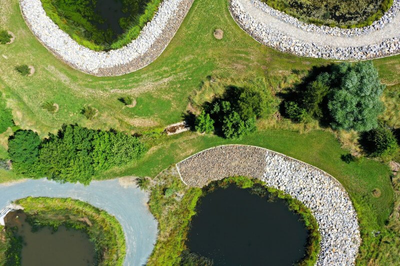
1.2 Consider the Area to Be Mapped
The size and complexity of the area to be mapped will impact your choice of drone. Smaller areas may require a drone with shorter flight times and limited payload capacity, while larger areas may necessitate a drone with longer flight times and the ability to cover larger distances. Consider the terrain, vegetation, and any potential obstacles in the area as well, as these factors can influence the type of drone and sensors you will need.
1.3 Analyze the Accuracy Requirements
Accuracy is crucial in aerial mapping and surveying projects. Determine the level of accuracy required for your project and ensure that the drone you choose is capable of delivering the desired results. Factors such as sensor resolution, georeferencing capabilities, and the ability to capture high-quality imagery can all affect the accuracy of the data collected.
2. Understand the Different Types of Drones Available
When it comes to drones for aerial mapping and surveying, there are three main types to consider: multirotor drones, fixed-wing drones, and hybrid VTOL (Vertical Take-Off and Landing) drones.
2.1 Multirotor Drones
Multirotor drones are the most common type used for aerial mapping and surveying due to their versatility and ease of use. They can hover in place, fly in any direction, and capture high-resolution imagery at close range. Multirotor drones are ideal for small to medium-sized areas and projects that require detailed mapping or inspection.
2.2 Fixed-Wing Drones
Fixed-wing drones are designed like airplanes and are well-suited for large-scale mapping projects. They have longer flight times and can cover larger areas in a single flight, making them efficient for expansive terrain. Fixed-wing drones are a great choice for projects that require speed and efficiency, such as agricultural surveys or mapping large construction sites.
2.3 Hybrid VTOL Drones
Hybrid VTOL drones combine the benefits of multirotor and fixed-wing drones. They can take off and land vertically like a multirotor, but also have the ability to transition to fixed-wing flight for longer endurance and increased coverage. Hybrid VTOL drones are a good choice for projects that require both close-up inspections and long-range mapping, such as infrastructure inspections or pipeline surveys.

3. Consider the Payload Capabilities
The payload capabilities of a drone are crucial for aerial mapping and surveying tasks. Consider the following factors when evaluating the payload capabilities of a drone:
3.1 Camera Specifications
The camera is the primary sensor used in aerial mapping and surveying. Pay attention to the camera’s resolution, focal length, and the ability to capture both RGB and multispectral imagery if required. Higher resolution cameras will result in more detailed and accurate maps.
3.2 Sensor Compatibility
In addition to cameras, other sensors like LiDAR (Light Detection and Ranging) or thermal sensors may be required for specialized projects. Ensure that the drone is compatible with the specific sensors needed for your project to gather the necessary data.
3.3 Weight and Size Constraints
Consider the weight and size constraints of the payload when choosing a drone. Some projects may require lightweight and compact drones that can easily navigate tight spaces, while others may need larger drones that can carry heavier payloads. Evaluate the weight and size limits of the drone and ensure it can accommodate your specific payload requirements.
4. Evaluate Flight Time and Range
Flight time and range are important considerations when selecting a drone, as they impact the efficiency and coverage of your aerial mapping and surveying operations.
4.1 Battery Life
Consider the battery life of the drone and how it aligns with the flight time required for your project. Longer battery life allows for extended flights, reducing the need for frequent battery swaps and increasing overall productivity.
4.2 Flight Range
The flight range of a drone determines how far it can travel from the operator’s location. Assess the flight range capabilities and choose a drone that can cover the desired area without the need for multiple takeoffs and landings.
4.3 Recharging Time
Take into account the recharging time of the drone’s batteries. Longer recharging times can be a bottleneck in operations, especially for projects that require repetitive flights. Look for drones with efficient charging systems or consider investing in additional batteries for uninterrupted workflow.

5. Assess the Required Software and Data Processing
Aerial mapping and surveying projects often require specialized software to control the drone and process the collected data.
5.1 Drone Control and Navigation Software
Evaluate the compatibility and features of the drone’s control and navigation software. Look for user-friendly interfaces, mission planning capabilities, and real-time monitoring to ensure smooth operations and accurate data collection.
5.2 Data Collection and Processing Software
Consider the data collection and processing software needed for your specific project. Look for software that is compatible with the type of data you are collecting, such as photogrammetry or GIS (Geographic Information Systems) software. Having the right software can streamline data processing and analysis, saving time and effort.
5.3 Compatibility with Existing GIS Software
If you already use GIS software for your mapping and surveying projects, ensure that the drone’s data is compatible with your existing systems. Seamless integration between the drone’s data and your GIS software will facilitate a streamlined workflow and maximize the value of collected data.
6. Consider Flight Safety and Regulations
Flight safety is a critical aspect of aerial mapping and surveying operations. Ensure that the drone you choose has the necessary safety features and adheres to local aviation regulations.
6.1 Obstacle Avoidance Systems
Obstacle avoidance systems can prevent collisions and ensure safe operations, especially when flying in complex or cluttered environments. Look for drones with advanced obstacle detection and avoidance capabilities to minimize the risk of accidents.
6.2 Built-in Safety Features
Consider drones with built-in safety features, such as return-to-home functionality or automatic landing in case of signal loss or low battery. These features can help prevent flyaways and ensure a safe return of the drone to the operator.
6.3 Compliance with Local Aviation Regulations
Ensure that the drone you choose complies with local aviation regulations and any specific requirements for commercial drone operations in your area. Familiarize yourself with the regulations and obtain the necessary permits or licenses to operate legally.

7. Evaluate Mobility and Portability
Mobility and portability are important factors to consider, especially if you need to transport and set up the drone in different locations.
7.1 Foldable and Compact Designs
Look for drones with foldable or compact designs that are easy to transport and store. This allows for greater mobility and convenience when traveling between project sites.
7.2 Transportation and Set-up Convenience
Consider how easily the drone can be transported and set up in the field. Look for features like quick-release propellers, tool-free assembly, and a lightweight design that facilitate efficient deployment and minimize downtime.
7.3 Weight and Handling
Evaluate the weight and handling of the drone, especially if you need to operate it manually or transport it over rough terrain. Lighter drones are generally easier to handle, while sturdy construction can withstand harsh environmental conditions.
8. Assess the Cost Considerations
The cost of the drone is an important factor to consider, taking into account both the initial investment and long-term maintenance and upkeep.
8.1 Initial Investment
Determine your budget and evaluate the initial investment required for the drone, including all the necessary accessories and software. Consider the value you will be getting from the drone in terms of its capabilities and how it aligns with your project requirements.
8.2 Maintenance and Upkeep
Look into the maintenance requirements of the drone and any associated costs. Consider factors such as spare parts availability, firmware updates, and technical support to ensure that you can keep the drone in optimal condition without incurring excessive expenses.
8.3 Replacement Parts and Repairs
Assess the availability and affordability of replacement parts for the drone. Accidents happen, and being able to easily and cost-effectively repair the drone is crucial to minimizing downtime and maintaining productivity.

9. Read Reviews and Seek Expert Opinions
Before making a final decision, take the time to read reviews and seek expert opinions on the drones you are considering.
9.1 Online Reviews and Ratings
Browse online forums, websites, and customer reviews to gain insights into the real-world performance and reliability of the drones you are interested in. Pay attention to both positive and negative experiences to make an informed decision.
9.2 Consultations with Professionals
Reach out to professionals in the aerial mapping and surveying industry for their expert opinions. Discuss your specific requirements and get their insights on the drones that would best suit your needs.
9.3 User Feedback and Recommendations
If possible, try to connect with other drone users who have experience in aerial mapping and surveying. Their feedback and recommendations can provide valuable guidance and help you make an informed choice.
10. Consider Training and Support
The right training and support can make a significant difference in the success of your aerial mapping and surveying projects.
10.1 Availability of Training Programs
Consider the availability of training programs for the drone you choose. Proper training can ensure safe operations, efficient data collection, and optimized use of the drone’s features and capabilities.
10.2 Drone Manufacturer Support
Assess the level of support provided by the drone manufacturer. Look for manufacturers that offer technical support, firmware updates, and readily available documentation to assist you in case of any issues or questions.
10.3 Warranty and Customer Service
Look for drones that come with a warranty and reliable customer service. A solid warranty ensures that you are protected against any manufacturing defects, while responsive customer service can help resolve any concerns or issues you may encounter during your aerial mapping and surveying projects.
By following these guidelines and thoroughly evaluating each aspect, you can choose the right drone for your aerial mapping and surveying needs. Selecting the most suitable drone will not only enhance the accuracy and efficiency of your projects but also contribute to their overall success.