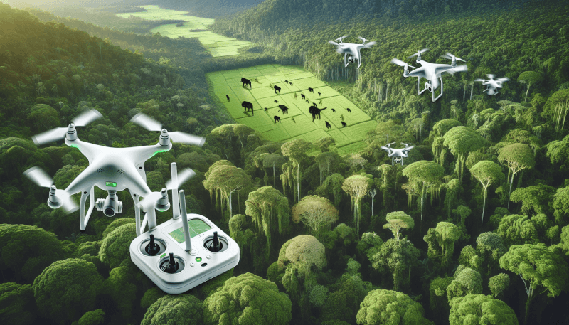
Imagine a world where unmanned flying robots, known as drones, are coming to the rescue of our struggling environment. These remarkable technological marvels are revolutionizing the field of environmental conservation by providing valuable insights, monitoring wildlife populations, mapping landscapes, and detecting illegal activities. With their ability to access remote and challenging terrains, drones are proving to be an invaluable tool in the fight to protect our planet’s precious ecosystems. In this article, we will explore the various ways drones are being utilized for environmental conservation and how they are making a tangible difference in preserving our natural world.
Understanding Drones
Overview of Drones
Drones, also known as unmanned aerial vehicles (UAVs), are aircraft that are operated without a pilot on board. These small, remote-controlled devices have become increasingly popular in recent years, and their applications extend far beyond recreational use. Drones are now being utilized in various fields, including environmental conservation. Their ability to capture high-resolution images, collect data from hard-to-reach areas, and provide real-time monitoring has made them invaluable tools in protecting our planet.
Advantages of Drones in Conservation
Drones have proven to be instrumental in conservation efforts due to several key advantages they offer. Firstly, their aerial perspective allows them to cover large areas quickly and efficiently, providing a comprehensive view of the environment. This, in turn, enables researchers and conservationists to gather more data in a shorter amount of time. Additionally, drones can access remote and hazardous locations that would otherwise be difficult or dangerous for human researchers to reach, such as dense forests or steep mountain slopes. Finally, the use of drones in conservation reduces the need for human presence, minimizing disturbances to wildlife and their habitats.
Monitoring Wildlife
Surveillance of Endangered Species
One of the critical applications of drones in conservation is the surveillance of endangered species. By deploying drones equipped with high-resolution cameras, researchers can monitor these species without directly disturbing them. Drones provide a non-intrusive way to observe wildlife behavior, reproductive patterns, and health indicators. The collected data can then be analyzed to gain valuable insights into population dynamics and aid in the development of effective conservation strategies.
Study of Migratory Patterns
Drones have also revolutionized the study of migratory patterns in various species. By tracking their movements from the air, researchers can better understand migration routes, feeding grounds, and nesting sites. This information is crucial for devising conservation measures that protect these habitats and ensure the safe passage of migratory species. Drones have enabled researchers to gather data on a scale that was previously unattainable, greatly enhancing our knowledge of these complex phenomena.
Protecting Habitats
Detection of Deforestation
Deforestation is a major threat to global biodiversity and ecosystem stability. Drones equipped with powerful cameras and sensors can be employed to detect and monitor deforestation activities. By regularly surveying forested areas, drones can identify and document illegal logging operations, enabling authorities to take swift and effective action against deforestation. The real-time data provided by drones can play a crucial role in safeguarding precious forest habitats and preventing further loss of biodiversity.
Monitoring Forest Health
Drones equipped with advanced imaging technologies, such as thermal cameras and hyperspectral sensors, can assess the health of forests and detect early signs of stress or disease. By capturing detailed aerial images, drones can provide invaluable information about the overall condition of the vegetation, identifying areas of concern and guiding conservation efforts. This proactive approach to monitoring forest health allows for targeted interventions to mitigate the impact of factors such as climate change, invasive species, or pollution.
Improving Resource Management
Assessment of Water Quality
Water quality is a critical factor in maintaining healthy ecosystems and supporting diverse aquatic life. Drones equipped with specialized sensors can collect data on water quality parameters such as temperature, pH, turbidity, and nutrient levels. This information helps researchers and conservationists identify pollution sources, track the spread of contaminants, and assess the overall health of aquatic environments. By pinpointing areas of concern, drones enable more efficient and targeted resource management strategies, thereby safeguarding precious water resources.
Tracking Changes in Land Use
Efficient land use management is crucial for sustainable development and conservation. Drones equipped with high-resolution cameras and advanced mapping software can provide up-to-date and accurate information on land use changes over time. From monitoring urban expansion to tracking agricultural practices, drones enable researchers to analyze how human activities are impacting natural landscapes. This data informs decision-makers and helps develop strategies that balance economic development with environmental preservation.

Combatting Poaching
Surveillance of Poaching Activities
Poaching poses a significant threat to wildlife conservation worldwide, and traditional monitoring methods often fall short in detecting and deterring these illegal activities. Drones equipped with thermal and infrared cameras can survey vast areas and identify potential poaching hotspots. By providing real-time surveillance and collecting evidence, these drones enable law enforcement agencies to respond quickly and effectively, leading to increased interception of poachers and protection of endangered species.
Prevention of Illegal Wildlife Trade
Illegal wildlife trade is a multi-billion dollar industry that drives the decline of countless species worldwide. Drones equipped with high-resolution cameras and facial recognition software have been employed to monitor wildlife markets and track the movement of illegally traded animals. By gathering evidence and providing law enforcement agencies with actionable intelligence, drones are playing a vital role in curbing this illicit trade. Their ability to gather data from a safe distance ensures the safety of researchers and increases the efficiency of conservation efforts.
Assisting in Research
Data Collection for Scientific Studies
Drones have revolutionized data collection for scientific studies, providing researchers with a unique perspective and enabling them to gather information that would be otherwise inaccessible. From collecting air and water samples to tracking animal behavior and mapping ecosystems, drones offer a versatile platform for gathering critical data. The non-intrusive nature of drones also reduces stress on wildlife and improves the accuracy of the collected information, leading to more reliable research outcomes.
Mapping and Surveying of Environmental Features
Accurate mapping and surveying of environmental features are essential for effective conservation and land management. Drones equipped with high-resolution cameras, LiDAR, and other sensors can create detailed 3D models of landscapes, coastline, and other natural features. This data aids in identifying vulnerable areas, planning restoration projects, and monitoring changes over time. The speed and precision of drone-based mapping and surveying significantly reduce costs and labor requirements, making these techniques more accessible and efficient for environmental research.

Fighting Natural Disasters
Assessment of Damage After Disasters
Natural disasters, such as hurricanes, earthquakes, and wildfires, can cause extensive damage to ecosystems and infrastructure. Drones equipped with cameras and sensors can rapidly assess the extent of the damage, providing real-time data to emergency response teams and aiding in recovery efforts. By collecting high-resolution images and thermal scans, drones help identify areas that require immediate attention, facilitating the allocation of resources and minimizing delays in the recovery process.
Assistance in Search and Rescue Operations
In the aftermath of natural disasters, drones play a crucial role in search and rescue operations. Equipped with thermal cameras and advanced imaging technologies, drones can quickly locate and identify survivors in hard-to-reach or dangerous areas. By providing first responders with real-time aerial footage, drones enhance their situational awareness, enabling faster and more effective search and rescue efforts. This technology has proven to be invaluable in saving lives and minimizing the impact of natural disasters.
Managing Marine Environments
Monitoring Coral Reefs
Coral reefs are among the most biodiverse and fragile ecosystems on Earth, facing numerous threats, including climate change, pollution, and overfishing. Drones equipped with underwater cameras and sensors can capture high-resolution images and collect data on reef health, biodiversity, and water quality. This information helps researchers and conservationists monitor the condition of coral reefs, identify areas in need of protection, and develop strategies for their preservation. Drones offer a non-intrusive approach to reef monitoring, minimizing disturbances to delicate marine ecosystems.
Detection of Marine Pollution
The health of our oceans is vital for the well-being of both marine life and humans. Drones equipped with specialized sensors can detect and monitor various types of marine pollution, including oil spills, plastic debris, and harmful algal blooms. By capturing real-time data and precise locations, drones assist in the identification of pollution sources and facilitate swift response measures. This technology aids in the protection of marine habitats, allowing for prompt action to mitigate the impact of pollution and restore the health of vulnerable ecosystems.
Studying Climate Change
Tracking Glacial Retreat
Glacial retreat is a visible and alarming consequence of climate change. Drones equipped with high-resolution cameras and LiDAR technology provide researchers with a detailed view of glaciers and their changes over time. By comparing images and mapping elevation data, scientists can track the rate of glacial retreat, predict future impacts, and study the water resources that these glaciers provide. Drones have proven invaluable in documenting and raising awareness about the dramatic effects of climate change on our planet’s ice caps.
Monitoring Changes in Sea Levels
Rising sea levels present a significant challenge for coastal communities and ecosystems. Drones equipped with LiDAR technology and aerial cameras can survey coastal areas, capturing accurate elevation data and maps. By monitoring changes in sea levels over time, researchers can assess the vulnerability of coastlines, plan for adaptation strategies, and protect critical habitats. Drones provide a cost-effective and efficient means of collecting data on large coastal areas, contributing to our understanding of the impacts of climate change on our oceans.
Challenges and Future Potential
Limitations in Drone Technology
While drones have revolutionized environmental conservation, they are not without limitations. Battery life is a key constraint, limiting the flight time and range of drones. Additionally, adverse weather conditions, such as strong winds or heavy rain, can hinder their operation. Moreover, regulations surrounding drone use, such as flight restrictions and privacy concerns, present challenges that need to be addressed. Continued research and development in drone technology will be crucial to overcome these limitations and maximize their potential in environmental conservation.
Emerging Trends and Innovations
The future potential of drones in environmental conservation is vast. Researchers and innovators are continuously exploring new ways to enhance drone capabilities and address existing challenges. Advancements in artificial intelligence and machine learning algorithms enable drones to autonomously analyze collected data, improving their efficiency and accuracy. Advancements in battery technology are extending flight times, while developments in miniaturization are enabling the deployment of small, lightweight drones in even more challenging environments. The integration of drones with other technologies, such as satellite imagery and remote sensing, opens up exciting possibilities for multi-platform data collection and analysis.
In conclusion, drones have emerged as powerful tools in environmental conservation, offering unique advantages in monitoring wildlife, protecting habitats, improving resource management, combating poaching, assisting in research, fighting natural disasters, managing marine environments, studying climate change, and overcoming various challenges. With continuous advancements in technology and growing recognition of their potential, drones are set to play an increasingly significant role in safeguarding our planet’s biodiversity and promoting sustainable development.
