If you’re new to the world of drones, understanding the various types of sensors used in these unmanned aerial vehicles can seem a bit overwhelming. But fear not! In this beginner’s guide, we will break down the different types of sensors commonly found in drones and explain how they work. Whether you’re a hobbyist looking to explore the skies or a professional seeking to utilize drones for photography or surveying, this guide will give you a clear understanding of the sensors that make drones so versatile and powerful. So get ready to embark on an exciting journey into the fascinating world of drone sensors!
1. Introduction to Drone Sensors
Drones have become increasingly popular in recent years, with applications ranging from aerial photography and videography to search and rescue missions. These unmanned aerial vehicles (UAVs) are equipped with a wide range of sensors that play a crucial role in their operations. In this article, we will provide a comprehensive overview of the different types of sensors used in drones, their functions, and their applications.
Basics of drone sensors
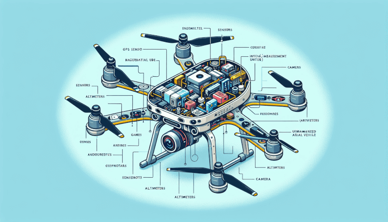
Drone sensors are electronic devices that collect data from the UAV’s surroundings and provide the necessary information for the drone to navigate, stabilize, and perform specific tasks. These sensors act as the drone’s eyes, ears, and even nose, allowing it to gather information about its environment and make informed decisions.
Importance of drone sensors
Sensors are indispensable components of drones as they enable the UAVs to perceive and interact with their surroundings. By providing real-time data on various parameters such as altitude, position, orientation, and environmental conditions, sensors ensure safe and accurate drone operations. Without sensors, drones would be unable to navigate, avoid obstacles, or carry out precise tasks.
Role of sensors in drone operations
Drone sensors play a vital role in the overall operation and performance of UAVs. They are responsible for collecting data about the drone’s position, speed, altitude, and orientation. This information is then used by the drone’s flight control system to maintain stability, control movements, and execute commands. Sensors also enable drones to perceive and respond to external factors such as wind, temperature, pressure, and proximity to objects.
2. Inertial Measurement Unit (IMU) Sensors
Definition and functions of IMU sensors
Inertial Measurement Unit (IMU) sensors are an integral part of drone sensor systems. IMU sensors consist of a combination of accelerometers, gyroscopes, and magnetometers that work together to provide essential data about the drone’s motion and orientation. The accelerometer measures acceleration forces, the gyroscope detects rotation rates, and the magnetometer determines the drone’s heading by sensing the Earth’s magnetic field.
These IMU sensors play a crucial role in stabilizing the drone, providing accurate position and attitude information, and compensating for external disturbances. They are responsible for maintaining the drone’s stability, controlling its altitude and orientation, and ensuring precise positioning during flight.
Types of IMU sensors used in drones
There are various types of IMU sensors used in drones, ranging from low-cost sensors for recreational drones to high-precision sensors for professional and industrial applications. Some common types include MEMS-based (Micro-Electro-Mechanical Systems) sensors, fiber optic gyros, and GPS-aided inertial navigation systems.
Applications of IMU sensors in drone navigation
IMU sensors are fundamental for drone navigation and control. They enable drones to accurately determine their position, altitude, and orientation, allowing them to navigate autonomously or follow specific flight paths. IMU sensors are particularly crucial in drone applications such as aerial mapping, surveying, inspection, and delivery, where precise positioning and stability are essential for successful mission execution.

3. Global Positioning System (GPS) Sensors
Overview of GPS sensors in drones
Global Positioning System (GPS) sensors are widely used in drones to obtain accurate positioning information. GPS sensors receive signals from a network of satellites to determine the drone’s latitude, longitude, and altitude. This data is crucial for navigation, waypoint tracking, and geolocation.
Working principle of GPS sensors
GPS sensors work by triangulating signals received from at least four satellites. The sensors measure the time it takes for signals to travel from the satellites to the drone, allowing them to calculate the distance between the drone and each satellite. By knowing the position of these satellites, the GPS sensors can determine the drone’s position through trilateration.
Accuracy and limitations of GPS sensors
GPS sensors provide relatively high-accuracy positioning information, typically within a few meters. However, certain factors like signal interference, multipath reflections, and limited satellite visibility can affect GPS accuracy. In urban environments or areas with dense foliage, the availability of satellite signals may be limited, leading to diminished accuracy. To overcome these limitations, drones often rely on alternative positioning technologies, such as Differential GPS (DGPS) or Real-Time Kinematic (RTK) systems, which provide higher levels of accuracy.
4. Barometric Pressure Sensors
How barometric pressure sensors work in drones
Barometric pressure sensors, also known as altimeters, play a crucial role in determining the drone’s altitude and measuring changes in atmospheric pressure. These sensors utilize the principle that atmospheric pressure decreases with increasing altitude. By measuring the changes in atmospheric pressure, barometric pressure sensors can calculate the drone’s relative height from the ground.
Applications of barometric pressure sensors in drones
Barometric pressure sensors are widely used in drones for altitude hold, navigation, and vertical positioning control. They help drones maintain a steady altitude during flight, compensating for changes in atmospheric pressure caused by weather conditions or altitude variations. Additionally, barometric pressure sensors are essential for altitude-based tasks such as aerial mapping, terrain following, and precision landing.
Benefits and challenges of using barometric pressure sensors
One of the significant advantages of barometric pressure sensors is their ability to provide accurate and instantaneous altitude information. They are relatively inexpensive, lightweight, and consume low power. However, barometric pressure sensors are affected by weather changes, such as barometric pressure fluctuations due to temperature variations or weather systems. To minimize these effects, advanced sensor fusion techniques and calibration methods are employed to enhance the accuracy of altitude measurements.

5. Optical Flow Sensors
Definition and purpose of optical flow sensors in drones
Optical flow sensors, also known as vision sensors, use optical techniques to estimate the drone’s motion relative to the ground. These sensors analyze the perceived changes in the optical flow of the ground texture to determine the drone’s speed, direction, and displacement.
Operating principle of optical flow sensors
Optical flow sensors calculate the drone’s motion by comparing consecutive frames captured by an onboard camera. By analyzing the displacement of visual features between frames, these sensors can measure the drone’s translational and rotational motion. This information is then used to stabilize the drone, improve position hold accuracy, and enable autonomous navigation capabilities.
Applications and advantages of optical flow sensors
Optical flow sensors are particularly useful in scenarios where GPS signals may be unavailable or unreliable, such as indoor environments or close to the ground. They enhance the drone’s stability and enable precise position hold even in the absence of GPS. Optical flow sensors are commonly used in applications like indoor navigation, obstacle avoidance, and autonomous landing.
The advantages of optical flow sensors include their compact size, low power consumption, and real-time responsiveness. They provide accurate motion estimation in various lighting conditions and are especially effective in low-speed maneuvers. However, these sensors may face limitations in areas with uniform textures or in situations where the ground features are not well-defined.
6. Ultrasonic Sensors
Introduction to ultrasonic sensors for drones
Ultrasonic sensors use sound waves beyond the audible range to measure distances and detect objects in the drone’s vicinity. These sensors emit high-frequency sound pulses and measure the time it takes for the pulses to bounce back after hitting a target.
Working mechanism of ultrasonic sensors
Ultrasonic sensors consist of a transducer that emits ultrasonic waves and receives their reflections. By measuring the time elapsed between sending and receiving the waves, these sensors can calculate the distance between the drone and an object. This distance information helps drones detect obstacles, perform collision avoidance, and maintain a safe operating distance from surrounding objects.
Applications and limitations of ultrasonic sensors
Ultrasonic sensors find applications in various drone tasks that require proximity detection and obstacle avoidance. They enable drones to fly in confined spaces, navigate around obstacles, and execute complex maneuvers. Ultrasonic sensors are particularly useful for indoor drones, where GPS signals may not be available, and visual sensors may be limited by lighting conditions or object recognition capabilities.
However, ultrasonic sensors have certain limitations. They are affected by environmental factors, such as temperature, humidity, and the reflective properties of objects. Additionally, their range and accuracy decrease with increasing distance, making them more suitable for short-range obstacle detection rather than long-range surveillance.

7. LiDAR Sensors
Overview of LiDAR sensors in drone technology
Light Detection and Ranging (LiDAR) sensors use laser beams to measure distances and create detailed 3D maps of the drone’s surroundings. These sensors emit laser pulses and measure the time taken for the pulses to travel to objects and back, allowing them to calculate the distance and shape of the objects.
Functionality and benefits of LiDAR sensors
LiDAR sensors provide accurate and high-resolution 3D mapping capabilities, making them valuable in a wide range of drone applications. They enable drones to detect and avoid obstacles, create detailed terrain models, generate point clouds for mapping and surveying, and perform object recognition tasks. LiDAR sensors also offer capabilities for simultaneous localization and mapping (SLAM), allowing drones to navigate autonomously in complex environments.
The benefits of LiDAR sensors include their ability to provide precise distance and elevation measurements, even in low-light conditions or adverse weather. They offer a wider field of view compared to other sensors, allowing for comprehensive coverage and detailed mapping. However, LiDAR sensors can be costly and have higher power requirements, making them more suitable for professional or research-oriented drone applications.
8. Thermal Sensors
Definition and applications of thermal sensors in drones
Thermal sensors, also known as infrared (IR) cameras, detect and capture infrared radiation emitted by objects. These sensors measure the temperature distribution of the drone’s surroundings and convert it into thermal images or videos, revealing heat signatures that are not visible to the human eye.
Thermal sensors find applications in various drone tasks that involve temperature monitoring, surveillance, and search and rescue operations. They enable drones to detect heat signatures emitted by humans, animals, or objects, allowing for enhanced situational awareness and target identification.
Working principle of thermal sensors
Thermal sensors work based on the principle of detecting infrared radiation emitted by objects. They use an array of infrared sensors to measure the intensity of infrared radiation at different wavelengths. By analyzing these measurements, thermal sensors determine the temperature distribution of the scene and create thermal images or videos.
Advantages and limitations of thermal sensors
Thermal sensors offer several advantages over other sensors in certain applications. They can operate in complete darkness and low-visibility conditions, making them ideal for night vision or surveillance tasks. Thermal sensors are also useful in detecting objects with a low contrast or concealed by foliage. Additionally, thermal imaging can be beneficial in identifying and tracking heat sources, such as fires or hotspots in industrial environments.
However, thermal sensors have limitations in terms of spatial resolution and the ability to provide accurate distance measurements. They are affected by environmental factors, such as atmospheric conditions or background clutter, which can influence the accuracy and interpretation of thermal images. Integration with other sensor types, such as visual or LiDAR sensors, can overcome some of these limitations and provide a more comprehensive understanding of the drone’s surroundings.

9. Infrared Sensors
Introduction to infrared sensors used in drones
Infrared sensors, also known as proximity sensors or obstacle detection sensors, are commonly used in drones for close-range object detection. These sensors emit infrared radiation and measure the intensity of the reflected radiation. By analyzing the reflected radiation, infrared sensors can detect the presence or absence of objects in the drone’s path.
Functionality and uses of infrared sensors
Infrared sensors serve an important role in collision avoidance systems and reactive control of drones. They help drones detect obstacles, maintain a safe distance, and avoid potential collisions. Infrared sensors are particularly effective in situations where other sensors, such as ultrasonic or LiDAR sensors, may not provide accurate measurements or fail to detect certain types of objects.
Advantages and challenges of using infrared sensors
Infrared sensors offer several advantages, including their ability to work independently of lighting conditions, making them suitable for both indoor and outdoor environments. They provide fast response times, enabling drones to react quickly to potential obstacles. Infrared sensors are also relatively compact, lightweight, and cost-effective.
However, there are challenges associated with infrared sensors. They have limited range and field of view, making them more suitable for close-range obstacle detection rather than long-distance surveillance. The accuracy of infrared sensors may also be affected by factors such as ambient temperature changes, reflective properties of objects, or environmental conditions.
10. Proximity Sensors
An overview of proximity sensors in drone technology
Proximity sensors are used in drones to detect nearby objects and provide distance measurements. These sensors utilize various technologies, such as ultrasonic, infrared, or electromagnetic fields, to sense the presence or absence of objects within a specific range.
Types of proximity sensors used in drones
There are different types of proximity sensors used in drones, each employing a specific technology for object detection. Ultrasonic sensors emit sound waves and measure the time taken for the waves to bounce back from objects. Infrared sensors detect the presence or absence of objects based on the reflection of infrared radiation. Electromagnetic sensors generate an electromagnetic field and measure the changes in the field caused by nearby objects.
Applications and limitations of proximity sensors
Proximity sensors are utilized in drones for various purposes, including obstacle detection, collision avoidance, and altitude control. They enable drones to fly safely in complex environments, navigate around objects, and perform precise landing maneuvers.
However, proximity sensors have limitations that need to be considered. They may be affected by environmental factors, such as temperature, humidity, or interference from other devices. The detection range of proximity sensors may also be limited, depending on the technology used and the properties of the objects being detected.
In conclusion, the various types of sensors used in drones play critical roles in enabling safe, accurate, and efficient drone operations. Each sensor type has its unique capabilities, advantages, and limitations, making them suitable for specific applications and environmental conditions. By understanding the functions and characteristics of these sensors, drone operators and enthusiasts can make informed decisions regarding sensor selection and utilization for their desired drone tasks.


