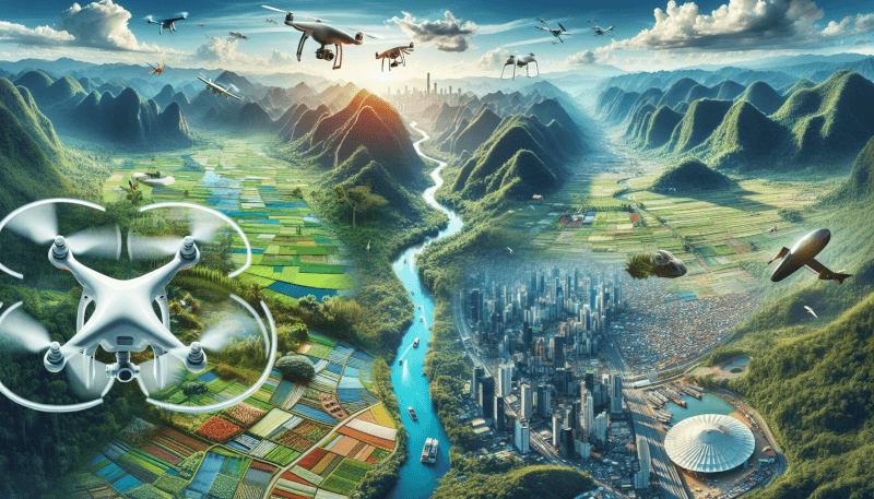
You are about to embark on a fascinating journey into the world of aerial photography. In this article, you will discover the true essence and meaning behind this captivating art form. Aerial photography is the unique and awe-inspiring practice of capturing images from a bird’s-eye view, providing an entirely new perspective on the world below. Through the use of drones, helicopters, or even hot air balloons, photographers can capture breathtaking images of landscapes, buildings, and events, unveiling a whole new dimension of beauty. Get ready to soar high and unlock the wonders of aerial photography.
What is Aerial Photography
Definition and Explanation
Aerial photography is the practice of capturing images of the Earth’s surface from an elevated position. It involves taking photographs from an aircraft, unmanned aerial vehicle (UAV), or satellite to obtain a unique perspective and detailed view of the landscape below. Aerial photography has become increasingly popular in recent years due to advancements in technology and equipment.
Historical Background
The history of aerial photography can be traced back to the mid-19th century when the first aerial photographs were taken using hot air balloons. However, it wasn’t until the early 20th century that aerial photography became more widespread, with advancements in aviation technology. During World War I, aerial photographs were used for military reconnaissance purposes, further fueling the development of this field.
Current Applications
Today, aerial photography is used in various industries and fields due to its versatility and ability to provide valuable insights. Some of the current applications of aerial photography include cartography and mapping, environmental monitoring, archaeology and cultural heritage, real estate and property assessment, construction and infrastructure development, film and photography industry, remote sensing and geographical analysis, as well as surveillance and security.
Methods of Capturing Aerial Photographs
Manned Aircraft Photography
Manned aircraft photography involves capturing aerial images from traditional airplanes and helicopters. This method allows photographers or surveyors to have full control over the flight path and camera settings. Manned aircraft photography offers the advantage of high-quality images, as professional-grade cameras and lenses can be used. However, it can be costly and limited by air traffic regulations and weather conditions.
Unmanned Aerial Vehicle (UAV) Photography
Unmanned aerial vehicle (UAV) photography, also known as drone photography, has gained significant popularity in recent years. Drones equipped with cameras can capture aerial photographs from various angles and heights. This method offers flexibility, as drones can easily navigate through tight spaces and capture shots that would otherwise be difficult to obtain. UAV photography is more affordable compared to manned aircraft photography and can be used in various applications, from recreational purposes to professional use.
Satellite Imagery
Satellite imagery is another method of capturing aerial photographs. Satellites orbiting the Earth are equipped with high-resolution cameras that capture images of the planet’s surface from space. This method provides a global view and allows for the monitoring of large areas. Satellite imagery is extensively used in fields such as remote sensing, meteorology, and environmental monitoring. However, it may have limitations in terms of resolution and accessibility.

Types of Aerial Photography
Vertical Aerial Photography
Vertical aerial photography involves capturing images directly from above, with the camera looking straight down at the Earth’s surface. This type of photography is commonly used in cartography, urban planning, and land surveying. Vertical aerial photographs provide an accurate representation of the area, allowing for precise measurements and analysis.
Oblique Aerial Photography
Oblique aerial photography involves capturing images at an angle, rather than directly from above. This type of photography allows for a more artistic and three-dimensional perspective, providing a sense of depth and scale. Oblique aerial photographs are commonly used in advertising, tourism, and real estate industries to showcase landscapes, buildings, or events.
Orthophotography
Orthophotography is a type of aerial photography that combines the characteristics of vertical aerial photography and topographical mapping. It involves capturing images from an overhead perspective and then correcting them to eliminate distortions caused by the Earth’s curvature and camera tilt. Orthophotos are commonly used in geographic information systems (GIS), urban planning, and infrastructure development.
Infrared Aerial Photography
Infrared aerial photography uses cameras that capture images in the infrared spectrum of light. This type of photography is particularly useful in fields such as agriculture, environmental studies, and natural resource management. Infrared aerial photographs can reveal hidden information, such as variations in vegetation health or heat distribution, which is not visible to the naked eye.
Equipment and Tools for Aerial Photography
Cameras
Cameras used for aerial photography range from compact point-and-shoot cameras to professional DSLRs. The choice of camera depends on the specific requirements of the project, such as image resolution, sensor size, and functionality. High-resolution cameras are preferred for capturing detailed images, while specialized cameras may be used for specific applications like infrared or multispectral imaging.
Lenses
A variety of lenses can be used in aerial photography to capture different perspectives and focal lengths. Wide-angle lenses are commonly used to capture large areas, while telephoto lenses allow for zooming in on specific details. Specialized lenses, such as tilt-shift lenses, may be used for architectural photography or to correct distortions in vertical aerial photographs.
Filters
Filters can enhance the quality of aerial photographs by reducing glare, improving color saturation, or balancing exposure levels. Polarizing filters are particularly useful for reducing reflections and increasing color contrast, while neutral density filters can help to control exposure in bright conditions. Filters are typically attached to the camera lens and can be easily adjusted or removed during the flight.
Gimbals and Stabilization Systems
To ensure sharp and stable aerial images, gimbals and stabilization systems are used to minimize the effects of aircraft vibrations and motion. Gimbals are mechanisms that hold the camera and allow it to rotate smoothly, compensating for any movement of the aircraft. Stabilization systems, such as gyroscopes or electronic stabilization, further enhance the stability of the camera during flight.
Drones and UAVs
Drones, or unmanned aerial vehicles (UAVs), have revolutionized aerial photography by offering a cost-effective and accessible method of capturing images from the sky. Drones are equipped with cameras, GPS, and other sensors, allowing for precise positioning and control. They range from small recreational drones to professional-grade quadcopters capable of carrying high-quality cameras.
Aircraft
Traditional manned aircraft, such as airplanes and helicopters, are still commonly used for aerial photography, especially for larger-scale projects or in areas with strict regulations. These aircraft are equipped with specialized camera mounting systems, such as gyro-stabilized gimbals, to ensure steady and clear images. Aircraft-based aerial photography offers the advantage of higher altitude and longer flight durations.

Applications of Aerial Photography
Cartography and Mapping
Aerial photography plays a crucial role in cartography and mapping, providing detailed and up-to-date topographic information. It is used to create accurate maps, measure distances, conduct land surveys, and update geographic databases. Aerial photographs serve as a valuable resource for urban planning, infrastructure development, and environmental management.
Environmental Monitoring
Aerial photography is widely used for environmental monitoring, especially in areas where access may be limited or hazardous. It enables the assessment of land cover changes, monitoring of wildlife habitats, and identification of environmental disturbances. Aerial photographs help scientists and conservationists study ecosystems, assess the impact of natural disasters, and monitor the health of forests, wetlands, and coastal areas.
Archaeology and Cultural Heritage
Aerial photography has revolutionized the field of archaeology, allowing researchers to discover and document ancient sites and artifacts. Aerial photographs reveal hidden patterns, structures, and features that may not be visible from the ground. They provide a valuable tool for archaeological surveys, site mapping, and the preservation of cultural heritage. Aerial photography is also used in the study of ancient civilizations and the documentation of historical landscapes.
Real Estate and Property Assessment
Aerial photography is widely used in the real estate industry to showcase properties, provide perspective, and capture eye-catching images for marketing purposes. Aerial photographs offer a unique view of properties, highlighting features such as location, proximity to amenities, and surrounding landscapes. They are also used for property assessment, boundary mapping, and site selection in real estate development.
Construction and Infrastructure Development
Aerial photography plays a vital role in the construction and infrastructure development industry. It provides accurate and up-to-date information for site planning, design, and monitoring. Aerial photographs help construction companies assess project progress, identify potential issues, and optimize logistics. They are also used for infrastructure inspections, surveying, and documentation of construction sites.
Film and Photography Industry
Aerial photography has become a significant asset to the film and photography industry, allowing for unique cinematic shots and perspectives. It is used in movies, documentaries, commercials, and music videos to capture breathtaking aerial footage and stunning landscapes. Aerial photographs enhance storytelling, provide context, and create immersive visual experiences.
Remote Sensing and Geographical Analysis
Aerial photography is an essential tool in remote sensing and geographical analysis, providing valuable data for scientific research and data analysis. Aerial photographs, combined with advanced image processing techniques, allow for the extraction of valuable information, such as land cover classification, vegetation analysis, and water resource monitoring. They contribute to the understanding of geographical processes, climate change, and natural resource management.
Surveillance and Security
Aerial photography is used for surveillance and security purposes in various industries, including law enforcement, border control, and private security. It provides a bird’s-eye view of areas of interest, allowing for real-time monitoring, threat detection, and situational awareness. Aerial surveillance helps in crime prevention, disaster management, and ensuring public safety.
Benefits and Advantages of Aerial Photography
Enhanced Perspective and Coverage
Aerial photography offers a unique perspective that is not easily achievable from the ground. It allows for a comprehensive view of the landscape, showcasing patterns, features, and relationships that may not be apparent from a lower vantage point. Aerial photographs provide a wide coverage area, enabling the observation of large-scale environments and capturing detailed images of remote or inaccessible locations.
High-Resolution Imaging
With advancements in camera technology, aerial photography can now produce high-resolution images. This level of detail is particularly valuable in applications such as mapmaking, environmental monitoring, and infrastructure development. High-resolution aerial photographs allow for accurate measurements, analysis, and visualization of features, enabling better decision-making and planning.
Cost-Effective
Aerial photography has become more cost-effective and accessible with the advent of drones and unmanned aerial vehicles. They offer a more affordable alternative to manned aircraft photography, without compromising on image quality. Drones are relatively inexpensive to operate, requiring minimal fuel and personnel. This affordability has opened up aerial photography to a wider range of users, including hobbyists, small businesses, and researchers.
Time-Saving
Aerial photography significantly reduces the time and effort required for data collection and surveying. Traditional ground-based methods often involve time-consuming fieldwork, manual measurements, and physical inspections. Aerial photographs can cover large areas quickly, capturing thousands of images in a single flight. This speed and efficiency save valuable time, enabling faster analysis, decision-making, and project completion.
Non-Invasive Data Collection
Aerial photography allows for non-invasive data collection, minimizing the impact on the environment and the subjects being studied. Unlike ground surveys or invasive sampling techniques, aerial photography does not require physical contact or disturbance of the natural or cultural heritage. It provides an indirect way to collect valuable information while preserving the integrity of the studied area.
Increased Safety
Aerial photography offers increased safety compared to traditional ground-based methods or manned aircraft photography. Drones can access hazardous or hard-to-reach areas without risking human lives. They can be used for inspection and monitoring of infrastructure, dangerous structures, or disaster-stricken areas. Aerial photography also improves safety in law enforcement and security operations, providing an aerial view without direct human presence.
Challenges and Limitations of Aerial Photography
Weather and Environmental Conditions
Aerial photography is heavily dependent on weather and environmental conditions. Strong winds, rain, fog, or low visibility can make it unsafe or impossible to conduct flights. In certain areas prone to extreme weather conditions, such as hurricanes or storms, aerial photography may not be feasible. Light conditions, such as harsh shadows or overcast skies, can also affect the quality and interpretability of aerial photographs.
Restrictions and Regulations
Aerial photography is subject to various restrictions and regulations, particularly when using drones or operating in controlled airspace. These regulations aim to ensure safety, privacy, and compliance with aviation rules. Pilots may need to obtain licenses or certifications, and certain areas may be off-limits or require permission for aerial photography. Compliance with privacy laws and regulations is also essential.
Technical Challenges
Aerial photography presents technical challenges that need to be addressed for successful image capture and data analysis. Factors such as camera stability, vibration, and motion control can affect image quality. Image stitching and alignment techniques are required for creating seamless mosaics or orthophotos. Managing large datasets, storing and processing imagery, and integrating it with other data sources require technical expertise and infrastructure.
Operational Costs
While drones have reduced the cost of aerial photography, there are still operational expenses to consider. These include the purchase or rental of equipment, maintenance, insurance, and training. In some cases, hiring specialized personnel or professional pilots may be necessary. For large-scale projects or frequent aerial surveys, operational costs can be significant and should be considered in project planning and budgeting.
Data Processing and Analysis
Aerial photography generates large volumes of data that require processing and analysis. This includes image stitching, sensor calibration, georeferencing, and classification. Sophisticated software and computing resources are needed to manage and analyze aerial imagery effectively. Data interpretation and extraction of meaningful insights require expertise in image processing, remote sensing, and geographical analysis.
Ethical Considerations in Aerial Photography
Privacy Concerns
Aerial photography raises privacy concerns, as it can potentially capture images of individuals, private property, or sensitive information. The use of drones equipped with cameras has sparked debates surrounding privacy and surveillance. It is essential to respect privacy regulations, obtain consent when necessary, and ensure that aerial photography is conducted in a way that respects the rights and expectations of individuals.
Informed Consent
In certain situations, obtaining informed consent from individuals or organizations is necessary before conducting aerial photography. This is particularly true when photographing private property, archaeological sites, or culturally sensitive areas. Researchers, photographers, or commercial operators should inform and seek consent from the relevant stakeholders, ensuring transparency and adherence to legal and ethical standards.
Cultural Sensitivity
Aerial photography in culturally significant areas or with indigenous communities requires cultural sensitivity and collaboration. It is important to involve local communities, respect their traditions, and seek their input and knowledge. Aerial imagery should be used to promote cultural understanding, heritage preservation, and community empowerment, rather than exploitation or disrespect.
Environmental Impact
Aerial photography, especially when using drones or manned aircraft, can have an environmental impact. It is crucial to minimize the ecological footprint by following environmental regulations, avoiding sensitive habitats, and reducing noise pollution. Operators should also consider the potential disturbance to wildlife and ensure that their activities do not harm or disrupt natural ecosystems.
Future Trends in Aerial Photography
Advancements in Technology and Equipment
The future of aerial photography lies in advancements in technology and equipment. Camera sensors will continue to improve in terms of resolution, dynamic range, and low-light capabilities. Drones will become more sophisticated and versatile, with longer flight times, increased payload capacity, and advanced autonomous features. New technologies, such as Lidar or hyperspectral imaging, will enhance data collection and analysis capabilities.
Integration of Artificial Intelligence
Artificial intelligence (AI) will play an increasingly significant role in aerial photography. AI algorithms can automate various tasks, such as image analysis, object recognition, and data interpretation. Machine learning algorithms can identify patterns in aerial imagery, extract features, and classify different land cover types. This integration of AI will streamline data processing, enable real-time decision-making, and improve the accuracy and efficiency of aerial photography.
Expansion of Applications
Aerial photography will continue to expand into new applications and industries. As technology becomes more accessible and affordable, more sectors will recognize the value of aerial imagery in improving efficiency, decision-making, and resource management. Industries such as agriculture, insurance, transportation, and urban planning are likely to embrace aerial photography to gain a competitive edge and enhance their operations.
Increased Accessibility and Affordability
The accessibility and affordability of aerial photography will continue to improve. As regulations evolve, the barriers to entry for commercial drone operators will be reduced, leading to increased competition and lower costs for aerial photography services. This accessibility will empower individuals, businesses, researchers, and community organizations to utilize aerial photography for a wide range of purposes, from creative endeavors to scientific research.
Conclusion
Aerial photography has come a long way since its inception and has become an invaluable tool in various industries and fields. The ability to capture images from an elevated vantage point provides unique perspectives and detailed views of the Earth’s surface. With advancements in technology and equipment, aerial photography is now more accessible, cost-effective, and versatile than ever before. As we look towards the future, the applications and benefits of aerial photography will continue to expand, shaping industries, driving innovation, and providing valuable insights into our world.